

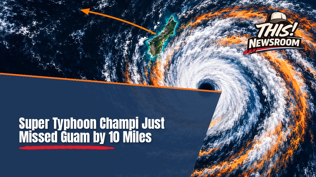
Ten miles. That was the margin on Guam early Sunday, when Super Typhoon Champi passed about 10 miles south of the island. The storm exploded in strength just before its closest approach, and that spared most residents the worst of it. For Typhoon Champi Guam residents, a few miles meant the difference between a rough night and a catastrophe.
The eye passed the island’s southern tip at 4:26 a.m. Guam time on Sunday, Oct. 18, according to The Guam Daily Post, which cites the National Weather Service. It was a super typhoon with 150 mph winds by then. Because of the time difference, some U.S. outlets date the pass to Saturday.
How the Champi Storm Went From Forecast Headache to Super Typhoon
Two days earlier, nobody expected this. Guam officials said Champi was a tropical storm with 40 mph winds and forecast to pass as a Category 2 typhoon, per a Guam Homeland Security advisory.
Then the storm outran the forecast. Sustained winds jumped from 85 mph Saturday morning to 130 mph by 7 p.m. One NWS forecaster called it “explosive intensification.”
The NWS then issued an Extreme Wind Warning for far southern Guam, for winds of 115 to 135 mph. Its message was blunt: “Venturing outside can result in death from flying projectiles.”
Why Guam Dodged the Worst
Here’s the thing: a few miles made all the difference. Most of Guam got tropical-storm winds with typhoon-force gusts. Airport gusts reached 80 to 85 mph, but the gauges at the airport, Apra Harbor and Pago Bay never recorded sustained typhoon-force winds of 74 mph.
The eye was only about 5 miles wide. Winds fell off fast within 10 to 15 miles of the center, and the storm’s speed of 15 to 16 mph also cut the time of exposure.
“It’s really hard to underscore how close this was to being a significant and devastating event for portions of Guam,” said Brandon Aydlett, science and operations officer at NWS Guam.
Earlier NWS statements warned that a direct crossing would destroy most metal-roof homes. Officials also projected near-total power loss and scarce drinking water. Storms that threaten several regions at once strain every response plan, as we saw when three hurricanes threatened North America at the same time.
What the Guam Typhoon Means for Residents Now
It was still a hard night. Authorities reported widespread power outages and water disruptions, according to The Watchers. So far, officials haven’t released outage figures. The Ugum water treatment plant is running on a standby generator because flooding muddied the Ugum River.
Guam remained under a Typhoon Warning and a Flash Flood Warning on Sunday. Officials told residents to stay in sturdy concrete shelter until they announce Condition of Readiness 4, per the latest government update. A High Surf Advisory runs through 4 p.m. Monday, with seas of 13 to 16 feet.
Crews haven’t assessed the far southern villages yet. So far, no reports of damage, injuries or deaths have surfaced. Flooding can outlast the storm itself, a pattern we covered when Isaias weakened but the flooding threat moved across the Southeast.
Federal Help and the Road Ahead
Guam’s and the Northern Mariana Islands’ governors asked for emergency declarations Friday. Isla Public reports that President Trump approved both, which lets FEMA coordinate assistance. We couldn’t find a White House or FEMA confirmation yet.
Champi isn’t done. By Sunday afternoon it was about 200 miles west of Guam and moving west at 14 mph. CBS News reports it could become a Category 5 early Monday. Early outlooks point it toward East Asia, with the Philippines, Taiwan or Japan possibly affected late this week.
For Guam, it’s the third strong typhoon since April. Residents spent Sunday indoors, hoping the island’s luck holds for the next one.